
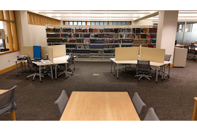
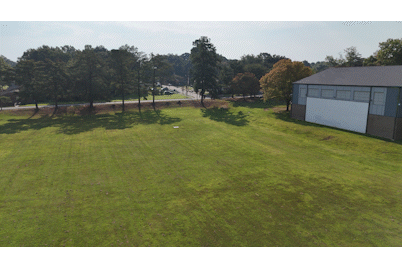
This summer the ZSR Administration team was kind enough to use some end-of-year funding to purchase a new camera drone. The idea is to use said drone for taking photos and videos of the library and all of our various events and spaces going forward from a whole new perspective! After a bit of research we landed on buying a DJI Mini 4 Pro, an ultralight 4K camera drone that provides a nice balance of ease of use, build quality, and camera quality. Buying the drone is the easy part though, the true challenge of taking to the sky is the legal side of things! The Federal Aviation Administration (FAA) regulates all air traffic, including small drones, and requires a special license to operate a drone for anything outside of recreational use, regardless of whether the drone is used for profit or not.
Thus began my summer long study session to become a “Certified Remote Pilot for Small Unmanned Aircraft Systems.”
The FAA’s main concern is safety, for both people on the ground where drones would be operating and keeping the airways clear of hazards for air traffic with people in the air. To do this, potential pilots are expected to have both a strong understanding of the various regulations on drone operations in the USA and to have some basic knowledge of aircraft and airport operations, meteorology, and risk mitigation skills. I had to put this knowledge to use in everyone’s favorite school pastime, a multiple choice test! Yay!
The biggest and most challenging section of the test dealt with reading and understanding aeronautical sectional charts. These charts are made for pilots to understand the airspace they will be flying through, potential hazards to avoid, and airspace restrictions around places like airports and military bases. Here’s what Winston-Salem looks like on one:
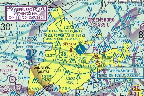
Most of that information isn’t too relevant to ZSR’s purposes, but one very important fact to glean is the airspace above ZSR for flying and filming around the building. The whole Reynolda Campus is within the Class D airspace around the Smith Reynolds Airport, the blue dotted line in the image, meaning that all the airspace from the ground up to 3500 feet above us is controlled. Luckily technology has made it incredibly easy to obtain permission to operate in our area, as there are a number of smartphone apps used to automatically request and process requests to operate in the airspace.
Some other interesting tidbits I picked up from my studies were how to read METAR and TAF weather reports used by airports and pilots to quickly disseminate weather information, basic aerodynamic principles like load factor, and why runways are number like they are. (Runway numbers are based on degrees on a compass, who knew?)
After reading through the regulations and FAA study guides and watching a bunch of the surprising numerous YouTube videos on the subject I headed to the testing center with my magnifying glass in hand. The test is 40 questions long and you have 2 hours to complete. Luckily I was well prepared so I was able to finish in less than hour and pass the test. A month and a half later I received my shiny new license in the mail.
A huge thanks to Thomas Dowling and everyone in ZSR Admin for allowing me this opportunity to learn and gain new skills! If you’re interested in getting some photos or video footage from the drone, or just want to check it out in action, please let me know. Always looking for a good excuse to take to the sky!
13 Comments on ‘ZSR and Barry Takes to the Sky’
This is so cool Barry! Thanks also for taking on the work of getting licensed – sounds intense but well worth the effort.
Barry, this is so awesome! Great work! And thanks for sharing! I had no idea of all that is involved in this process!
Very cool Barry and now you can add Certified Remote Pilot for Small Unmanned Aircraft Systems to your long list of skills!!
Congrats on your certification Barry! This is so cool. Until you started this venture I was never aware one needed to be certified to fly a drone.
Wow, this was a fascinating post, Barry! Congrats on your license, and thanks for sharing! I loved the sectional chart — I’ve never seen that type of map before.
Super cool, Barry! Good work!
You. Are. So. Cool.!!
That’s pretty intense, Barry! Congratulations on getting your license! I’m looking forward to seeing your drone footage in the future!
This is super rad! grats!!
Congratulations, Barry! Up, up, and away!
You are our very own “sky pilot” ! (Sky Pilot term borrowed from Eric Burdon & the Animals)
Congratulations on expanding your skill set and obtaining the cool new gadget! I had no idea it was that complicated to put a drone in the sky. I look forward to seeing the footage you obtain!
So cool, Barry! I learned a lot from this post, and I’m looking forward to the footage that you capture!